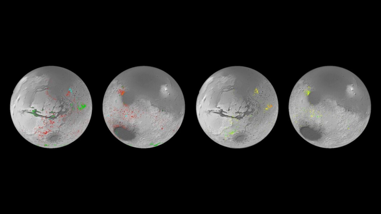
A new “water map” of Mars could offer fresh clues about the planet’s past — and potential landing spots for the future.
Researchers from the European Space Agency (ESA) spent a decade developing the map from data collected by two Mars orbiters.
They found hundreds of thousands of areas containing aqueous mineral deposits, which are created though interactions between rock and water.
As the minerals still contain water molecules, they could show locations where we can extract water for human bases on the planet.
These outcrops may also provide ideal sites for exploring whether life once began on Mars.
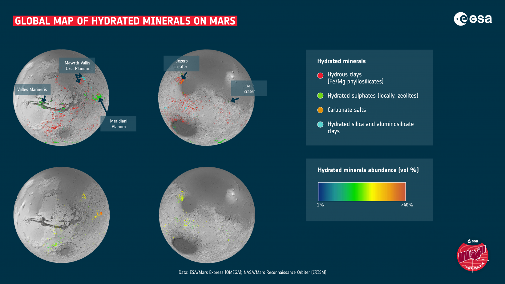
The map could provide a paradigm shift in our understanding of Martian history.
“This work has now established that when you are studying the ancient terrains in detail, not seeing these minerals is actually the oddity,” John Carter of the Institut d’Astrophysique Spatiale in Paris, said in a statement.
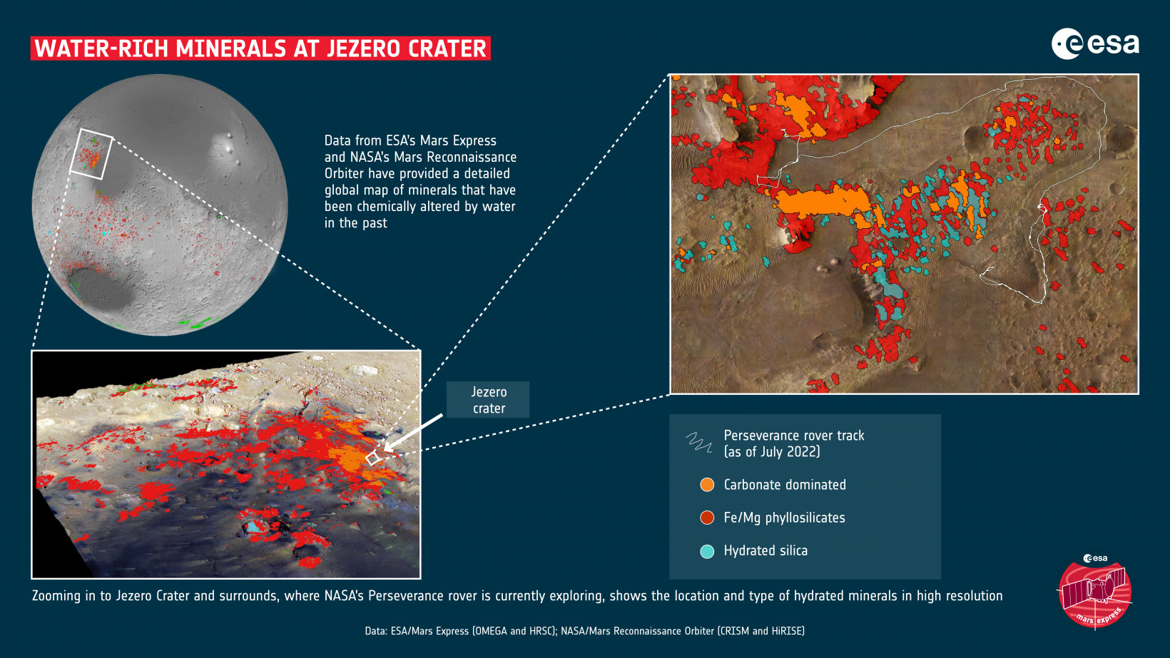
The map uses data from two complementary tools: the CRISM spectrometer on NASA’s Mars Reconnaissance Orbiter, and the OMEGA instrument on ESA’s Mars Express spacecraft.
The researchers combined the datasets to establish the locations and quantities of aqueous minerals.
They now will now examine the data for signs that water was either globally persistent or only present during short and intense periods. They will also search for evidence that Mars ever had a climate that could sustain life.
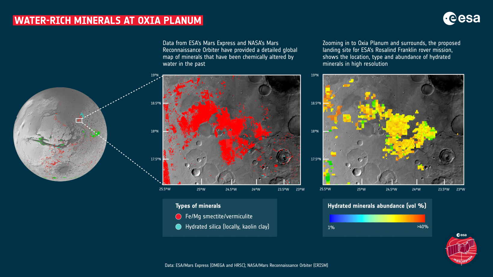
The team also hopes to gives Mars mission planners prime candidates for landing sites.
Humankind may be a small step closer to colonizing the red planet.
Get the TNW newsletter
Get the most important tech news in your inbox each week.
